Take a ride on the wild side of our Appalachian Backroads. Over 1,500 miles of vetted byways climb to the edge of the horizon and descend thousands of feet to verdant valleys below. Connect to our Appalachian Backroads from the famed Back of the Dragon which boasts 3 mountains, 438 curves in 32 miles. Spurs off the main routes offer one-of-a-kind adventures that will keep you coming back for more!
Our backroads span multi-lane highways to rolling rural roads with modest to moderate curves and straight-aways. Extraordinary vistas with breathtaking scenery will awaken the photographer in you, while the adventurer spies the next road less traveled. Cruise elevations to over 4,200 feet with the sun at your back and a smile on your face... Yes!
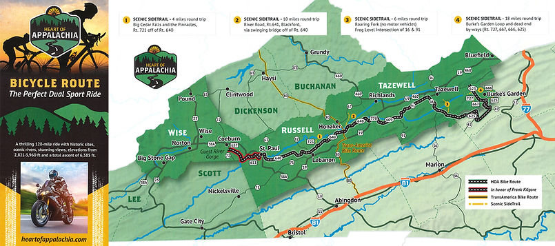
Bicycle Route Map

This 128-mile ride with 40 miles of side trails treks through backroads, rails to trails, single track, historic sites, a natural preserve, wilderness area, a swinging bridge, three scenic rivers, farms, coal country, and gorgeous views in far southwestern Virginia. It is a Virginia State recognized bicycle and scenic drive route! It is perfect for dual sports bikes!!!
NOTE: The riding surfaces are 80% paved and 20% gravel. The gravel sections are located at Clifton Farm in Russell County and the National Forest in Bland County.
Click here for a downloadable map. If you would like a map mailed to you, please see the button above titled 'Get the free map!'
** In honor of Frank Kilgore - this trail is still in progress and not totally accessible.

Check out a little this and that on and off the road...


